
 The Jordan River Commission and its project partners are making progress on the Jordan River Trail Wayfinding Signage Plan. This regional effort project is being undertaken in partnership with the Salt Lake County Health Department, Salt Lake County Parks & Recreation, National Parks Service Rivers, Trails, and Conservation Assistance Program, Wasatch Front Regional Council, West Jordan City, and other municipalities.
The primary goals of this effort are to:
- Create a cohesive and coordinated system of directional signage to enhance the the trail user experience, and to
- Encourage residents and visitors to become more physically fit by using the trail for recreation, commuting, and for physical activity.
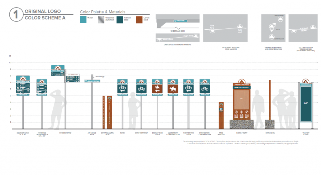
Alta Planning + Design is leading the development of the signage plan, which includes the following on-trail wayfinding sign types:
- Trailhead kiosks with maps and regulations
- Mileage markers and pavement markings
- Decision signs to be placed at intersections and indicating the distance and time to nearby destinations
- Jordan River Trail Confirmation and Turn signs
- Equestrian Trail Confirmation and Turn signs
- Street Crossing signs
The signage plan covers the entire Jordan River Trail corridor from Utah Lake to the Great Salt Lake. It does not include signage on city streets or connecting trail systems.
It is anticipated that the Jordan River Trail Wayfinding Signage Plan will be completed by December 2016. Grants and other funding are being sought to support the fabrication and installation of the new signs throughout the trail corridor.
