By Soren Simonsen, Executive Director
The Jordan River Commission is a regional partnership of over 40 local, state and federal governments, water and transportation agencies, and nonprofit and business stakeholders working to develop the Jordan River Parkway, and improve the Jordan River and its surrounding environments and watershed. Its work is guided by a regional community vision and strategic action plan known as the Blueprint Jordan River.
Not long after the Commission was formed, it developed a Guidebook for River Oriented Development in 2013. A decade later, we are seeing the vision and guiding principles reflected in numerous new and ongoing development projects.
The Point Development
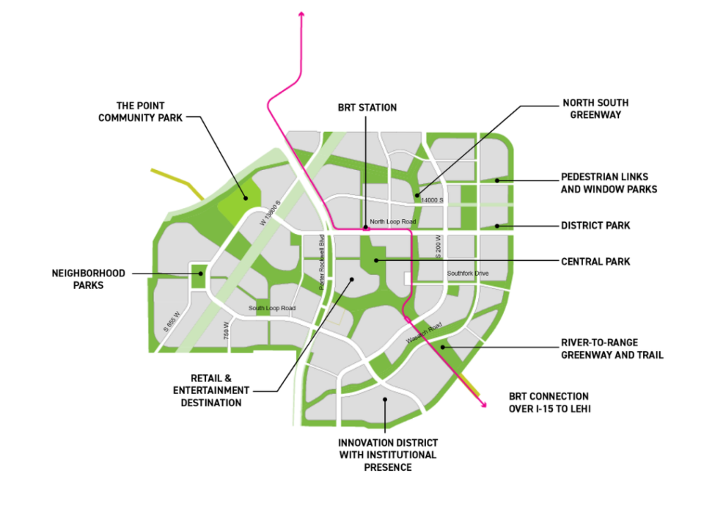
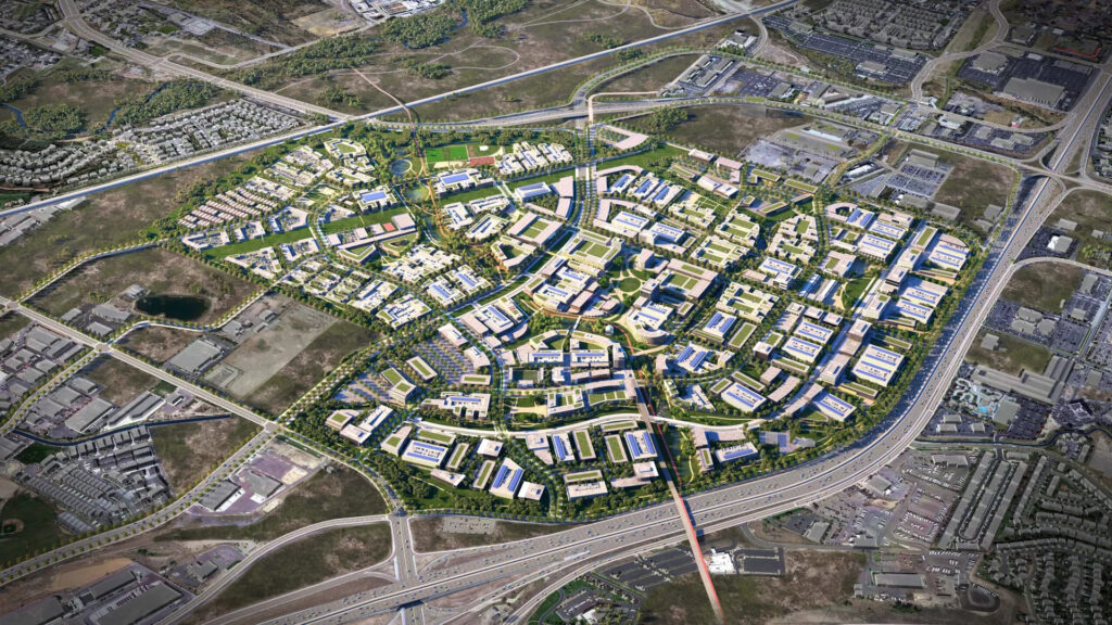
The Point is a large scale redevelopment of the former state prison site in Draper, over 600 acres in size. It is located adjacent to the Jordan River Parkway and the 252-acre Galena Soo’nkahni Preserve, the location of one of the oldest documented Indigenous dwelling and archeological artifact sites in Utah, dating back about 3,000 years.
Envision Utah led some of the early conceptual planning for the former prison site, guiding the state in forming The Point of the Mountain Land Use Authority to implement the project.
Envision Utah recommended the Jordan River Commission as a stakeholder and contributor to these planning efforts, and Commission staff served as technical advisors to The Point Framework Plan, supporting the subsequent master planning of this important river oriented community development. Through this partnership, three important Commission goals have been incorporated into The Point Framework Plan:
- Creating community connections to the Jordan River Parkway
- Managing stormwater to reduce harmful impacts
- Conserving water to enhance Jordan River in-stream flows
As works begins on Phase 1 of The Point, the Jordan River Commission is pleased to see the proposed River to Range trail and greenway as a prominent feature of the project. This includes a 1.4-mile paved regional trail that will connect the Jordan River Parkway Trail to the foothills of Draper’s Corner Canyon. The River to Range trail will not only expand and connect an important regional trail network, but will enhance experiences for residents of and visitors to The Point through abundant outdoor recreation and active commuting opportunities.
The River to Range greenway is a linear park that also serves as a natural system for responsible stormwater management and the restoration of ecological habitats for native plants and animals. The Framework Plan’s recommendation for 100% stormwater management on site, which not only keeps harmful pollutants from entering the Jordan River and nearby Corner Canyon Creek tributary, but will also serve to recharge the groundwater aquifer. Water conservation is also a key recommendation of the Framework Plan, with retained stormwater and low water, native landscapes reducing demand on precious water resources, which will result in improved flows in the Jordan River, ultimately benefitting the health and replenishment of Great Salt Lake.