
The Jordan River Commission is working with local governments and community stakeholders to implement plans to ensure safe and enjoyable boating from Utah Lake to the Great Salt Lake.
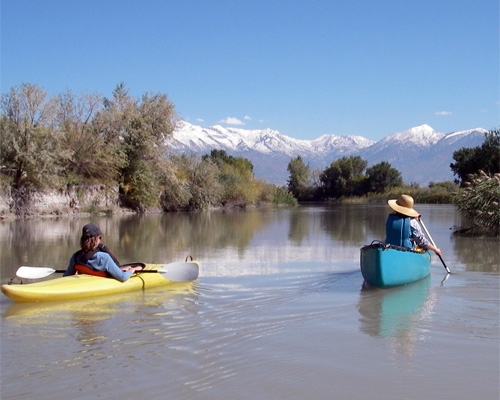
Boating is a wonderful way to experience the wildlife and beauty of the Jordan River. However, boating has inherent risks, and it is the responsibility of the boater to ensure their own safety when paddling the Jordan River. There are several natural and man-made hazards along the river, and some of these have claimed the lives of boaters.
All boaters are responsible for ensuring their own safety. Boaters must know their own skills and capabilities and assess river hazards or conditions accordingly—not all conditions will be safe for all levels of skill or capability.
Boaters must always wear appropriate personal flotation devices (PFDs) and having any other safety equipment necessary for safe paddling.
Conditions on the river can change without warning. Periods of high water flow, such as during spring snow melt or after storm events can create new or different hazards.
Boaters should scout out their route immediately before entering the water to evaluate current conditions. Boaters must know when and how to exit the river safely to avoid hazards. Boaters should not attempt to paddle the river during periods of swift, high flows.
Please contact local recreation departments to find information about current water conditions within their sections of the Jordan River Parkway.
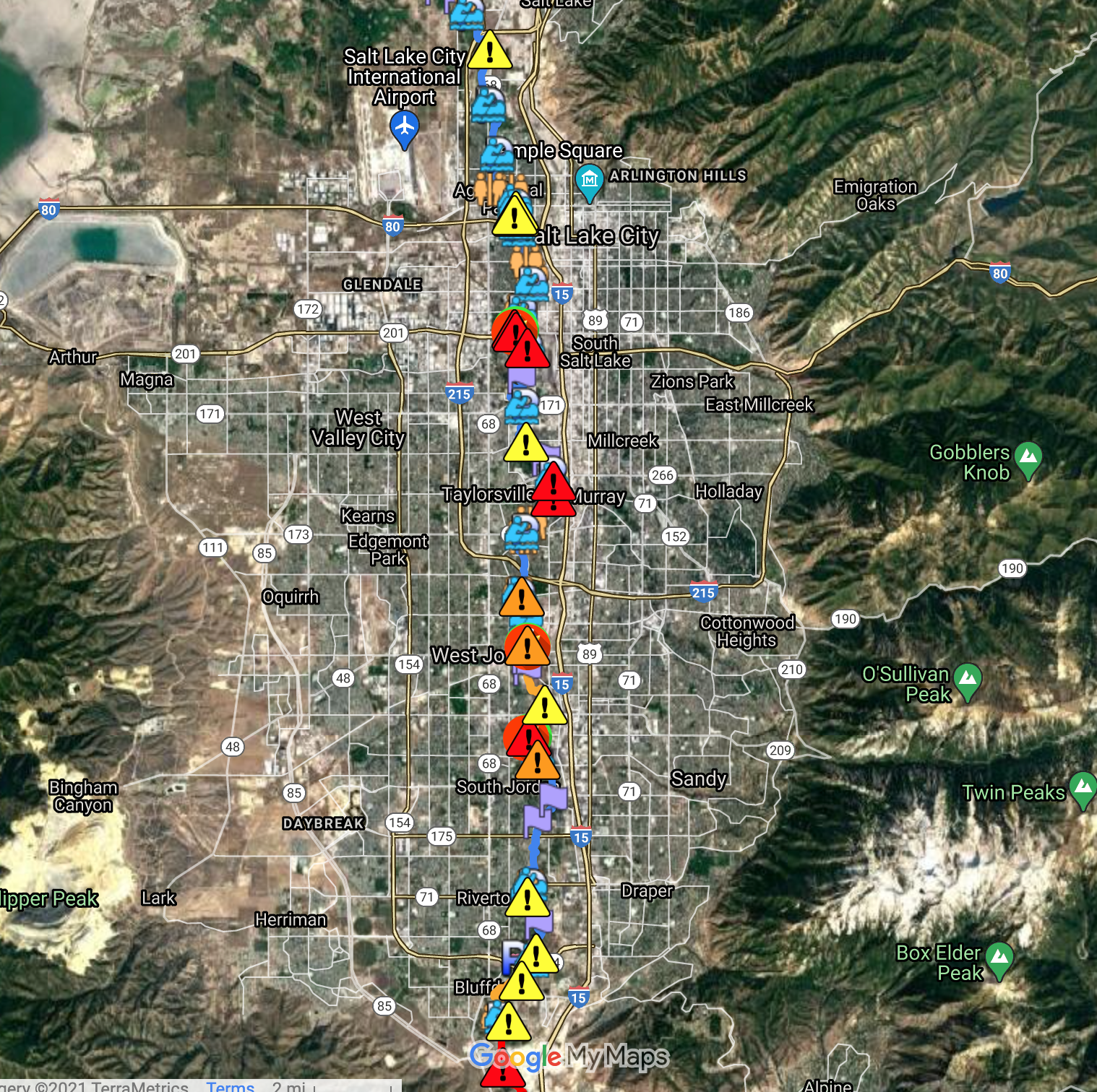
Water Trail Map
A working map of paddling opportunities on the Jordan River can be found below. This map is a work-in-progress. Please email us with any suggestions or corrections to make it more useful and accurate. Tips for those interested in boating on the Jordan River can be downloaded here: Boating Safety Tips.
NOTE: This map was created with the best available information in February 2021. We will make our best efforts to update the map with new access ramps and portages as they are completed.
Click on the map image below to open up a larger, interactive map.
Group Paddle Trips
The group Utah Outdoors leads regular trips down the Jordan river throughout the summer. Boaters will need to provide their own boat, paddles, and life jackets. These can be rented at several locations around the Wasatch Front. Click here to see dates or to sign-up for Utah Outdoors group paddle or bicycle trips.
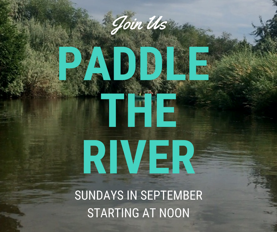 The Jordan River Commission also leads guided paddles weekly in September as part of the Get To The River Festival to paddle the length of the river in 4 weeks. Look for information on the Festival calendar, follow the JRC on social media, or subscribe to our newsletter.
Self Guided Paddle Trips
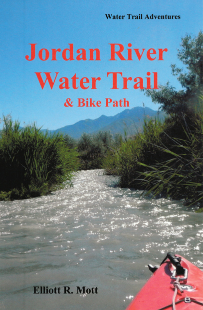
Elliott Mott’s book “Jordan River Water Trail & Bike Path” is an invaluable resource for paddling the Jordan River. The book has maps and details for access points and portages as well as advice on shuttling and paddling year round.
It’s available for purchase at the Division of Natural Resources Map Store and through this link.
Jordan River water trail enthusiast, Troy Adair, has also put together YouTube videos for the navigation of the Jordan River from Utah Lake to the Legacy Nature Preserve with maps from Elliott’s book and video footage of groups paddling these sections.
Here’s a link to the video playlist to view one or all of the paddling videos.
In addition, the following sites are popular references for boating in Utah.
Current water level readings
Current water flow at specific Jordan River sites from the U.S. Geologic Survey can be accessed here:
Surplus Canal (approximately 2100 South)
Water Trail Master Plan
The overall vision for the Jordan River Water Trail includes consistent signage along the river and at trailheads, formalized boat launch and take-out points, and safety interventions and signage at boater hazards. Several efforts are underway to mitigate navigational hazards that exist within the river, as well as to plan for, design, and implement a series of boater access facilities.
A preliminary Water Trail Master Plan can be found in the Salt Lake County’s Jordan River Trail Master Plan. Salt Lake County is planning to prepare an update and refinement of this plan in 2016, and funding is being sought to implement the plan once complete. The City of Saratoga Springs plans to install three boat launches in the Utah County in 2016, and two more are planned for the future. The City of North Salt Lake is actively working to construct a take-out and boater parking area at Center Street in the Davis County section of the river. This is also expected to be completed in 2016.
Finally, the Utah Division of Forestry Fire and State Lands is working with various local governments to mitigate, and eliminate where possible, the most dangerous navigational hazards to boaters in the river. In 2015, the deadly “Winchester Hazard” was re-engineered and the rapid is now safe to float for most boaters thanks to a partnership between the State, Murray City and Salt Lake County. Discussions are underway to address other significant hazards in the river.
